Trail: Kühtai
Location: Tyrol, Austria
Difficulty: Mountain hiking trail
Distance: 5.48km, Duration: 3:48:57
This amazing gem was completely unplanned. We originally planned an easy “recovery” hike near Innsbruck after enduring some suffer-fest (but fun!) hikes the past few days. On our drive to the trailhead, the GPS took us to a parking lot towards a pedestrian-only path. It became apparent that we had to park our car here, and walk over an hour to the actual trailhead. No way!
Looking through our list of trails, we realized that they were all mistaken as “loops” instead of “there and back”. Double the distance! It was already late in the morning – improvisation was calling our names. Thanks to the Maps.me app, we decided to give the nearby Kühtai area a try.
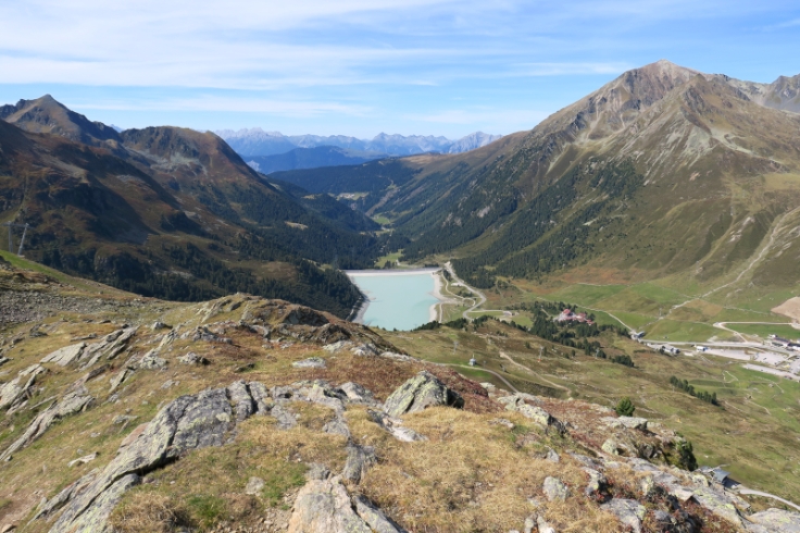
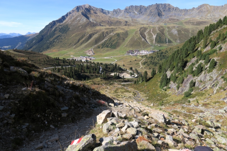
Kühtai exuded a ski village vibe. I’d imagine it to be busy during the winter, but for now in September, we stood alone in an empty parking lot. As we approached the start of the trail, we were already in for a treat … all the different plants and mosses created a unique array of colours.
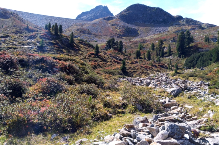
As we ascended towards the 1st cross, we zig-zagged up a path with streams of water trickling (sometimes gushing) down the mountain. The ground was also littered with beautiful shiny rocks. This trail certainly did not disappoint!
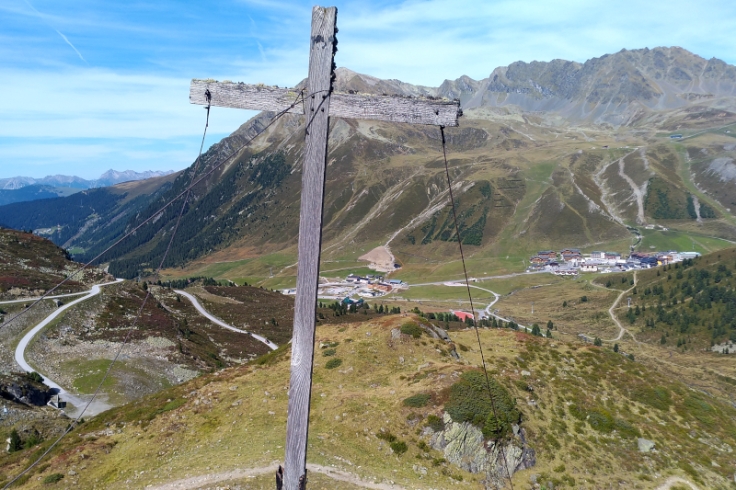
It was an enjoyable hike to the 1st cross (2232m), a worn out and slanted one. On my stronger days, I could send it flying down the mountain with my index finger.
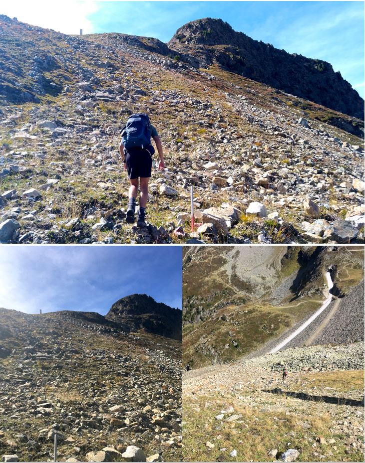
 The red and white markers eventually led us to what felt like a vertical climb (photos never do it justice!). I was on all fours, using both my hands to climb up. Not my idea of recovery day! The terrain began with piles of large rocks, eventually becoming grassy with small loose rocks that I shouldn’t have trusted as anchor. There were countless times when the rocks came loose as I grabbed onto them and I lost my balance for a split second. As if that wasn’t enough, I realized mid-way that my phone was in my unzipped pant pocket which could’ve fallen out if I lifted my knee too high. Slowly & steadily, I found a rock that supported my weight and managed to put my phone safely in my backpack. It took a good 15min to reach the end of this climb.
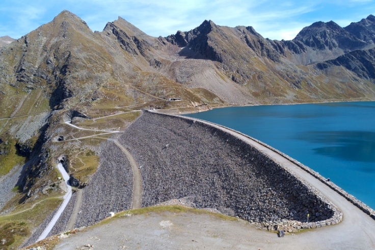
Once at the top, I was in absolute awe!! Just below us was the calm waters of Speicher Finstertal, an alpine lake/reservoir. I could not believe how blue the water was – truly the “bluest blue to ever blue”! We climbed over a rocky ledge to stand closer to the water and definitely spent a good chunk of time taking photos.
A bit more ascending and we reached the 2nd cross (Die Mute, 2398m) overlooking this reservoir.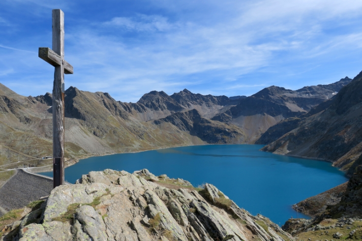
 We descended back to the rocky ledge by the reservoir to have our lunch. To avoid going down the steep rock pile we trekked up earlier, we opted for a paved road that tunneled through the mountain and led us back to the trail with the water streams near the bottom of the mountain.
It was there that a group of senior ladies overtook us and before we knew it, they were way ahead of us. It was incredible – age really does not matter here!
 An overall medium intensity and highly recommended trail. It is secluded, colourful, and definitely a hidden treasure in the area.
